All posts by The Dude

Red Horn Coral

IMAG0560I am a little reluctant to post this since I haven’t exactly become an expert on this particular area just yet. This is a chance for anyone reading this to help me out though ha ha ha! We visited this location the last two Saturdays and finally found the specific site spoken of in several of the resources I’ve come across (we think). Sometimes it is hard putting together all of the information out there or even just validating its accuracy in the first place. But here goes nothing…

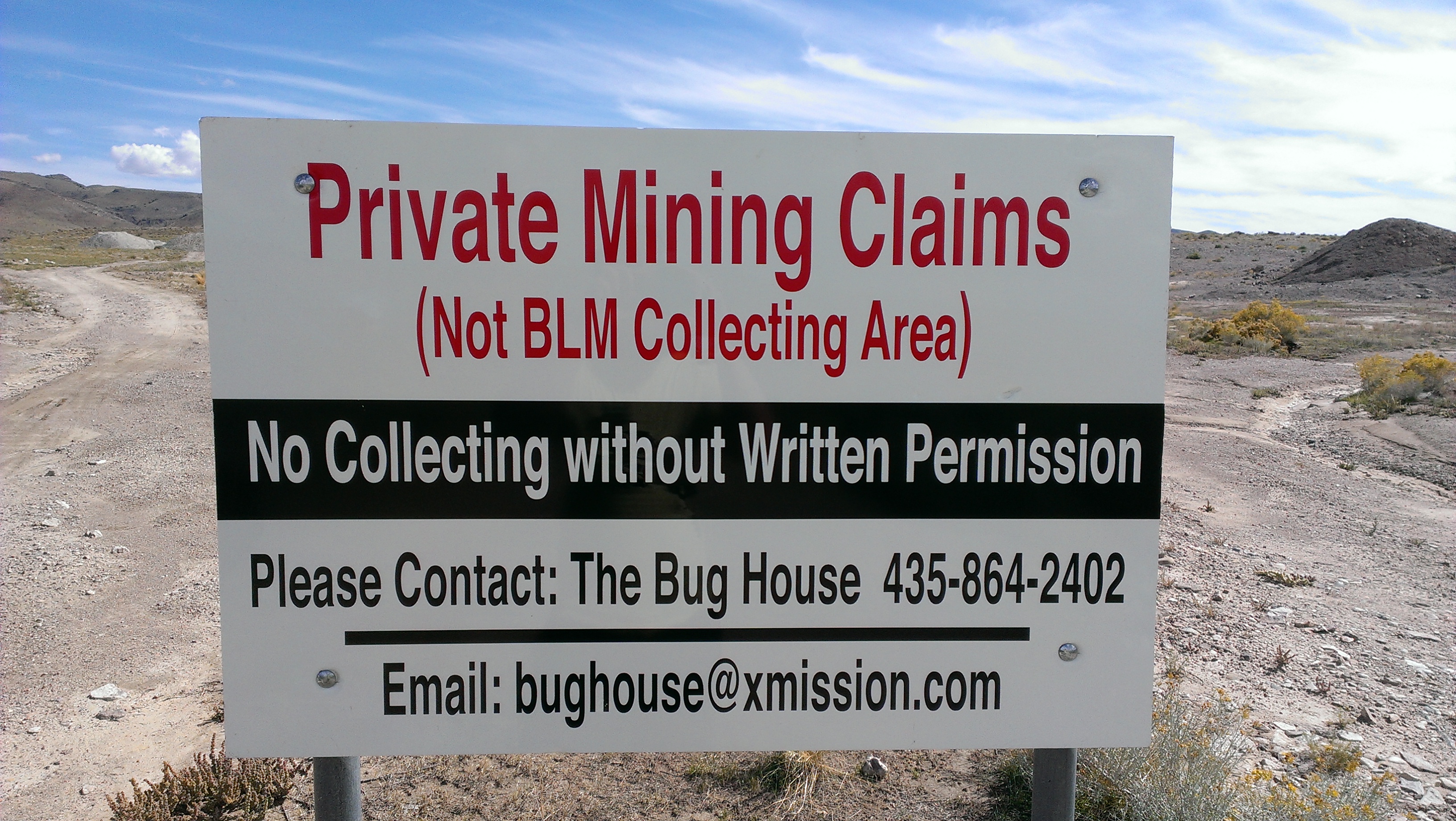
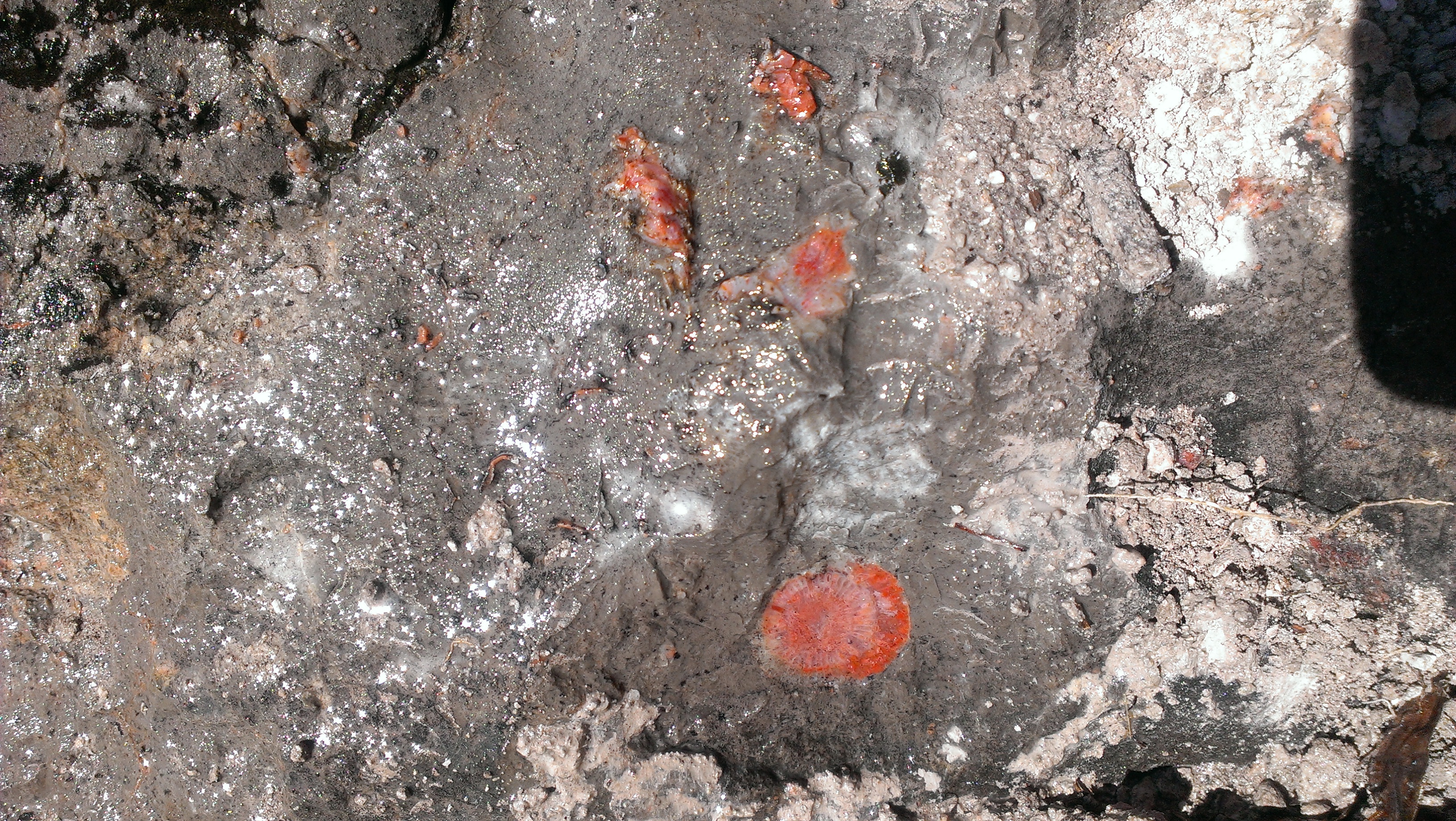
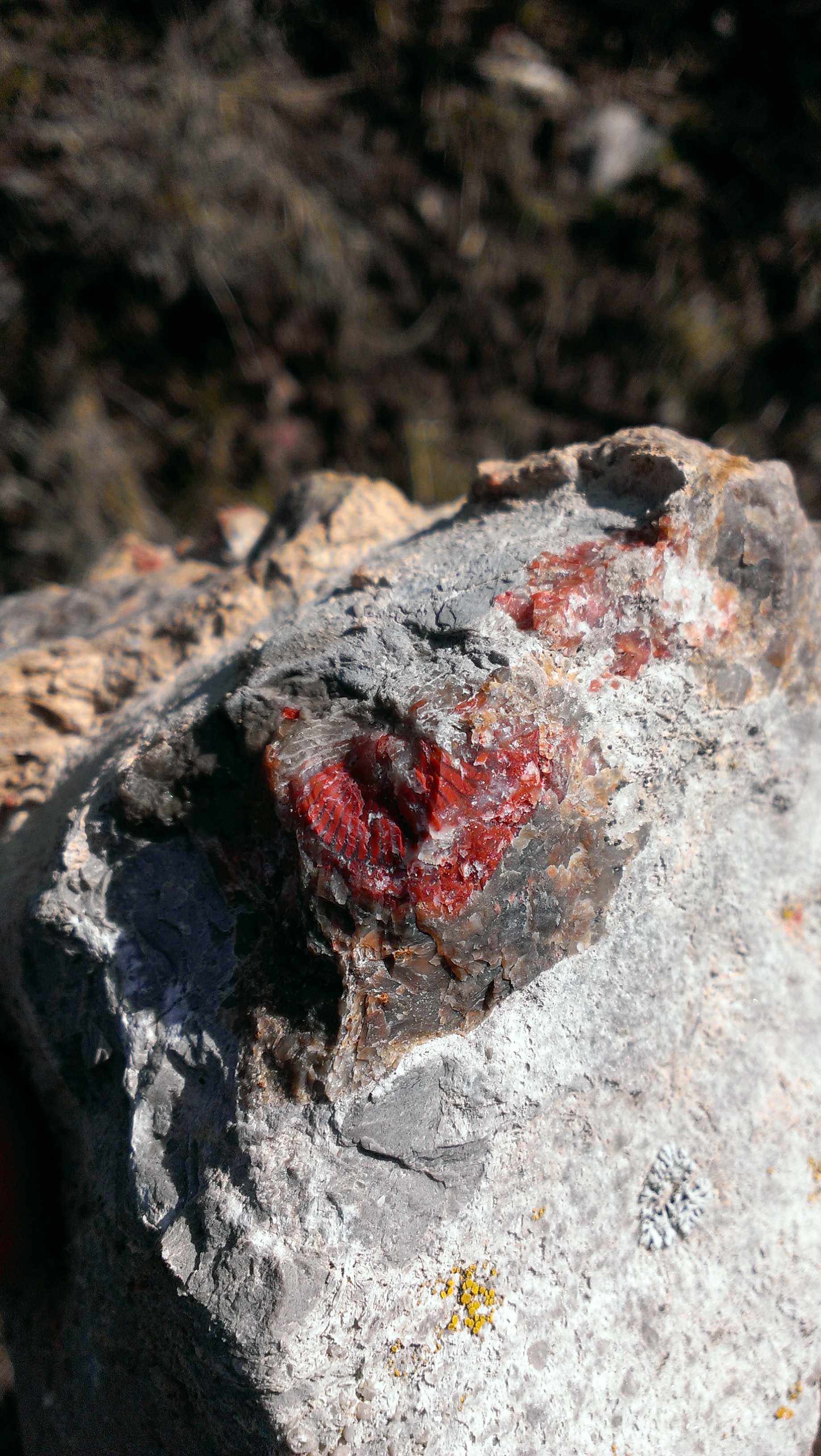
I am aware of previous and/or existing claims in this area. We came across one of these claims on one of the ridges (there was a little red shack next to it). On Google Earth or Google satellite view you can see this from above as a large white area on the map where the dirt road drops down a bit. It is just Northwest of the marker I placed on the map. We searched the hillsides around this claim and found chips and small pieces of the red horn coral, agate, jasper, and various fossils.

IMAG05851On the way back we met a couple of hikers who informed us that we had taken a wrong turn and ended up the wrong canyon. We spent the rest of the day searching the area they suggested we try, but were, for the most part, unsuccessful (not to mention extremely tired).

The next week, after searching online and staring at Google satellite images for hours on end, we determined to take the Cedar Hollow road just past the town of Woodland that seems to wrap up and around the location (mainly so we didn’t have to hike as much–we are lazy farts like that). After getting the Subaru stuck in a massive snow bank for a several hours, it became apparent that hiking in was our only chance.

IMAG0586
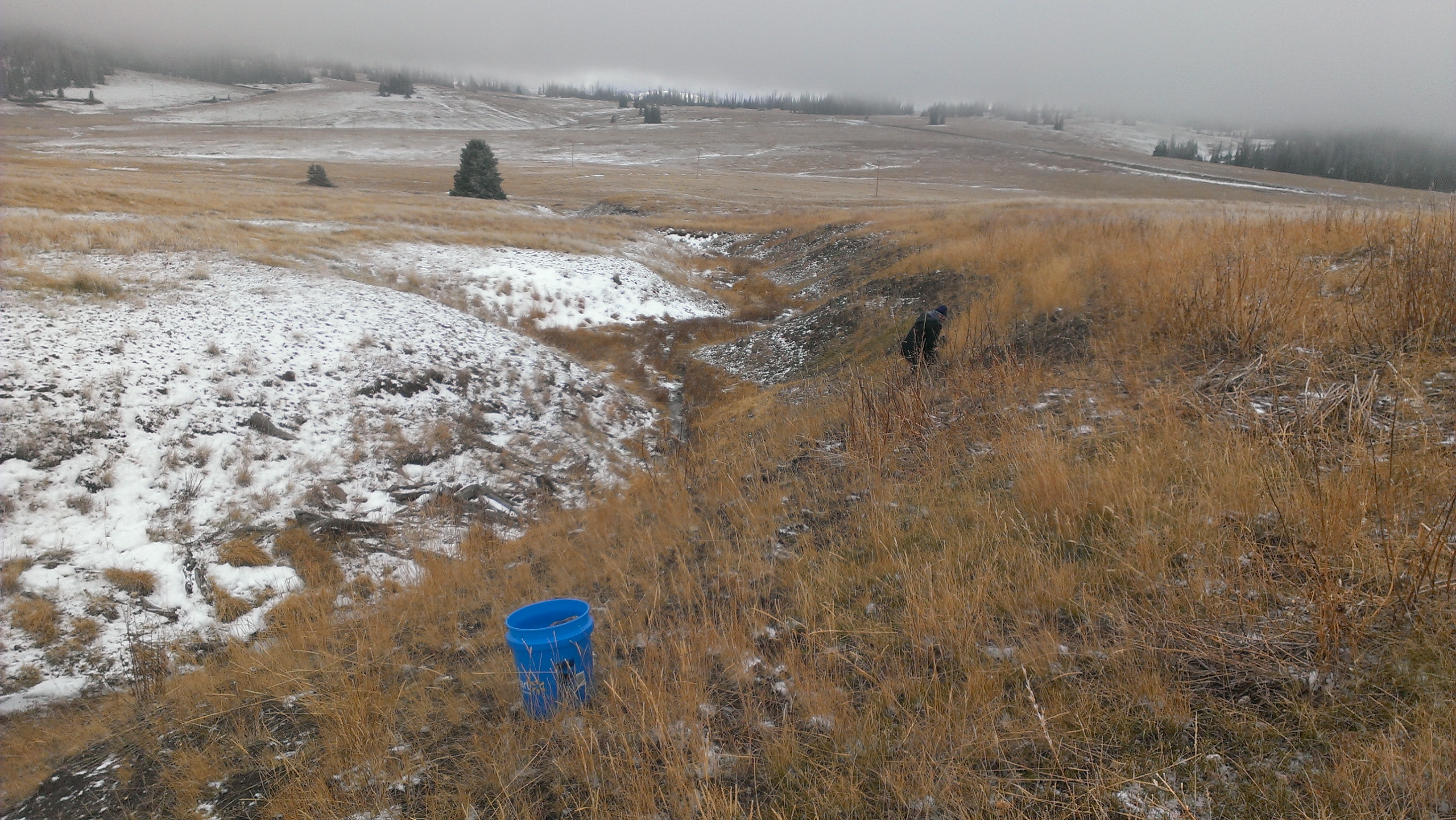
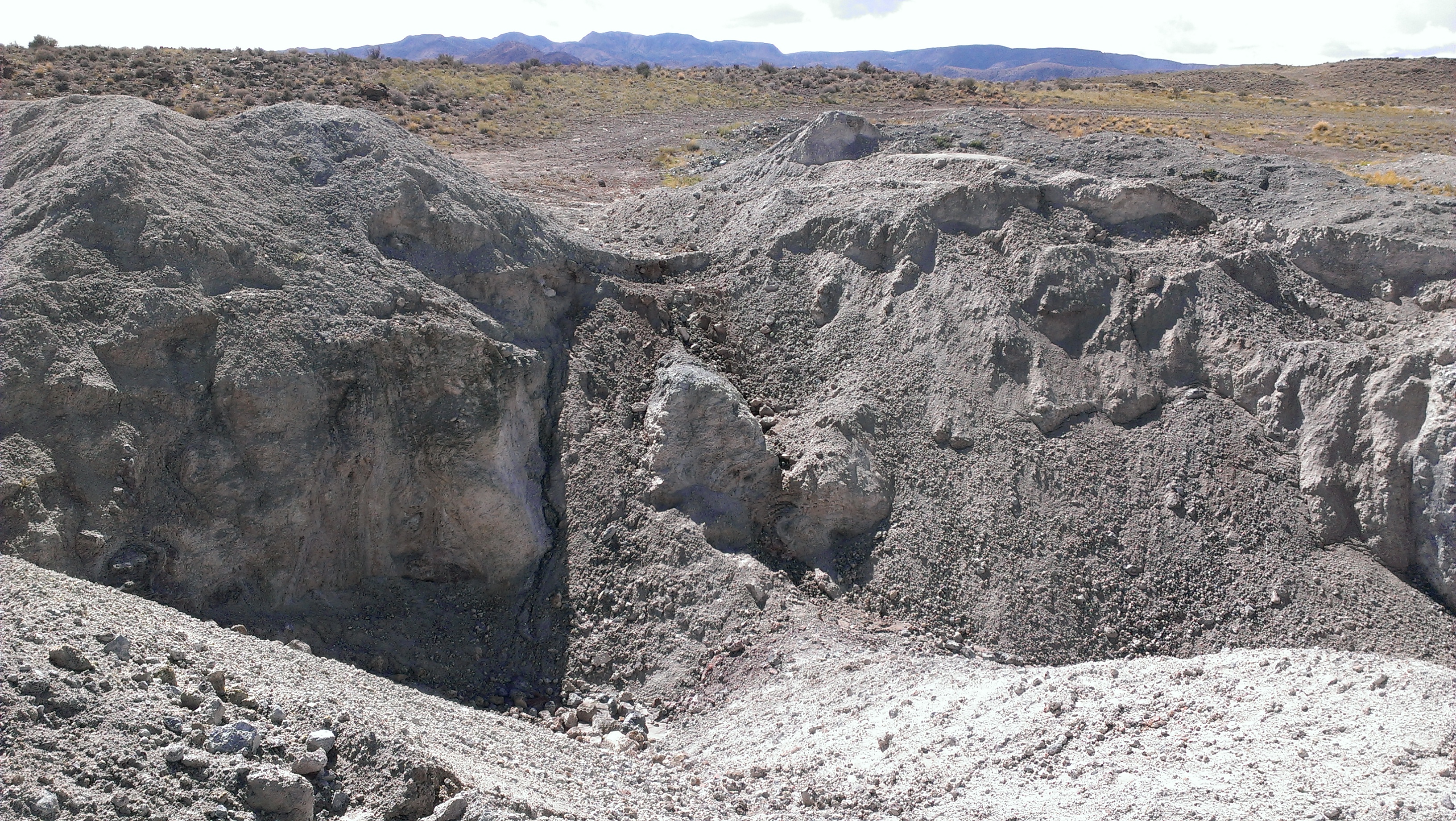
Many people we had asked about this location mentioned that it was about a mile and a half from the base of the canyon. After hiking that distance, we searched long and far all over both sides of the trail, but still were only able to find bits and pieces. It was only with about 30-45 minutes before we had to leave for the day that we finally found what we presume to be the location.

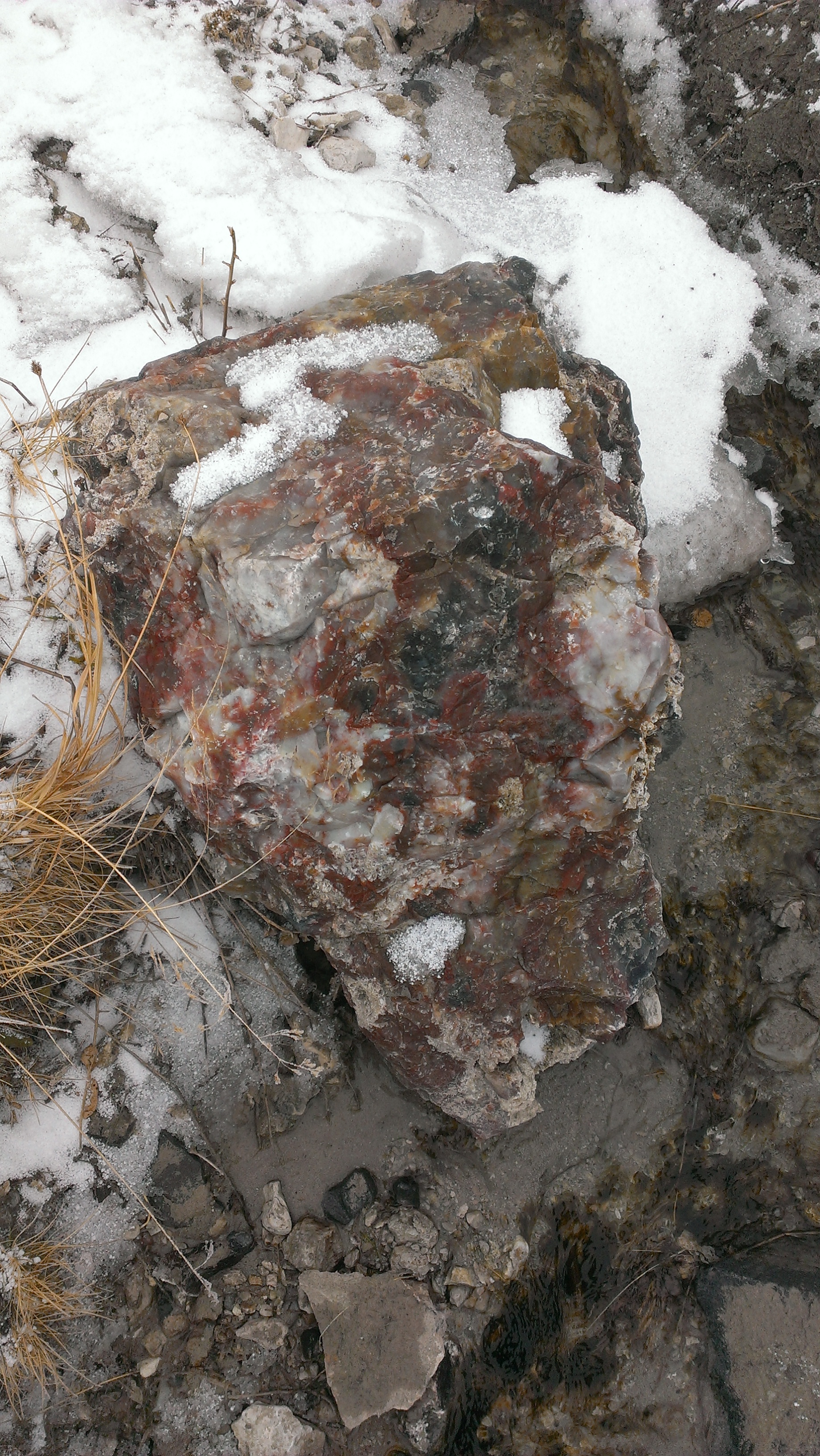
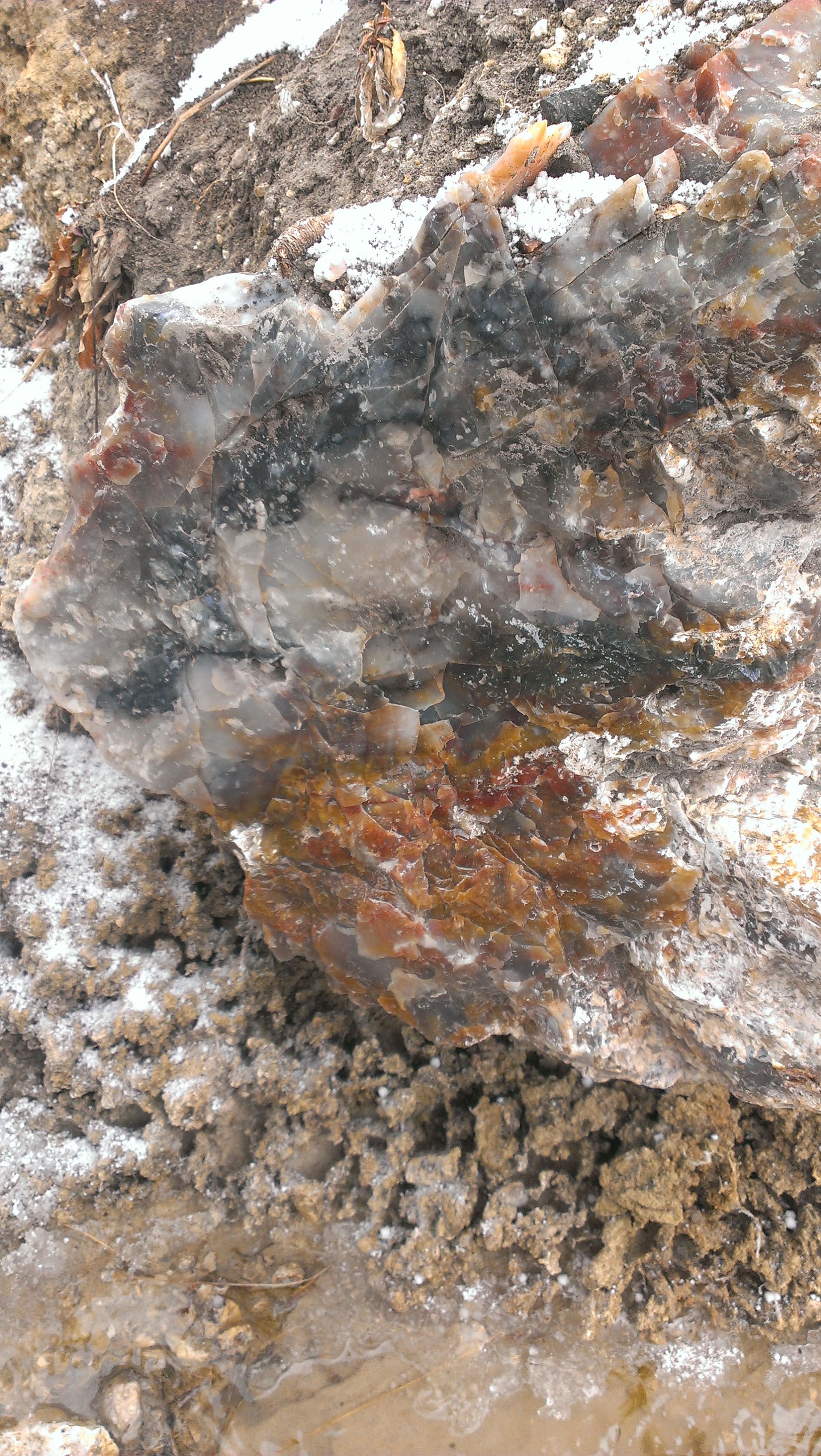
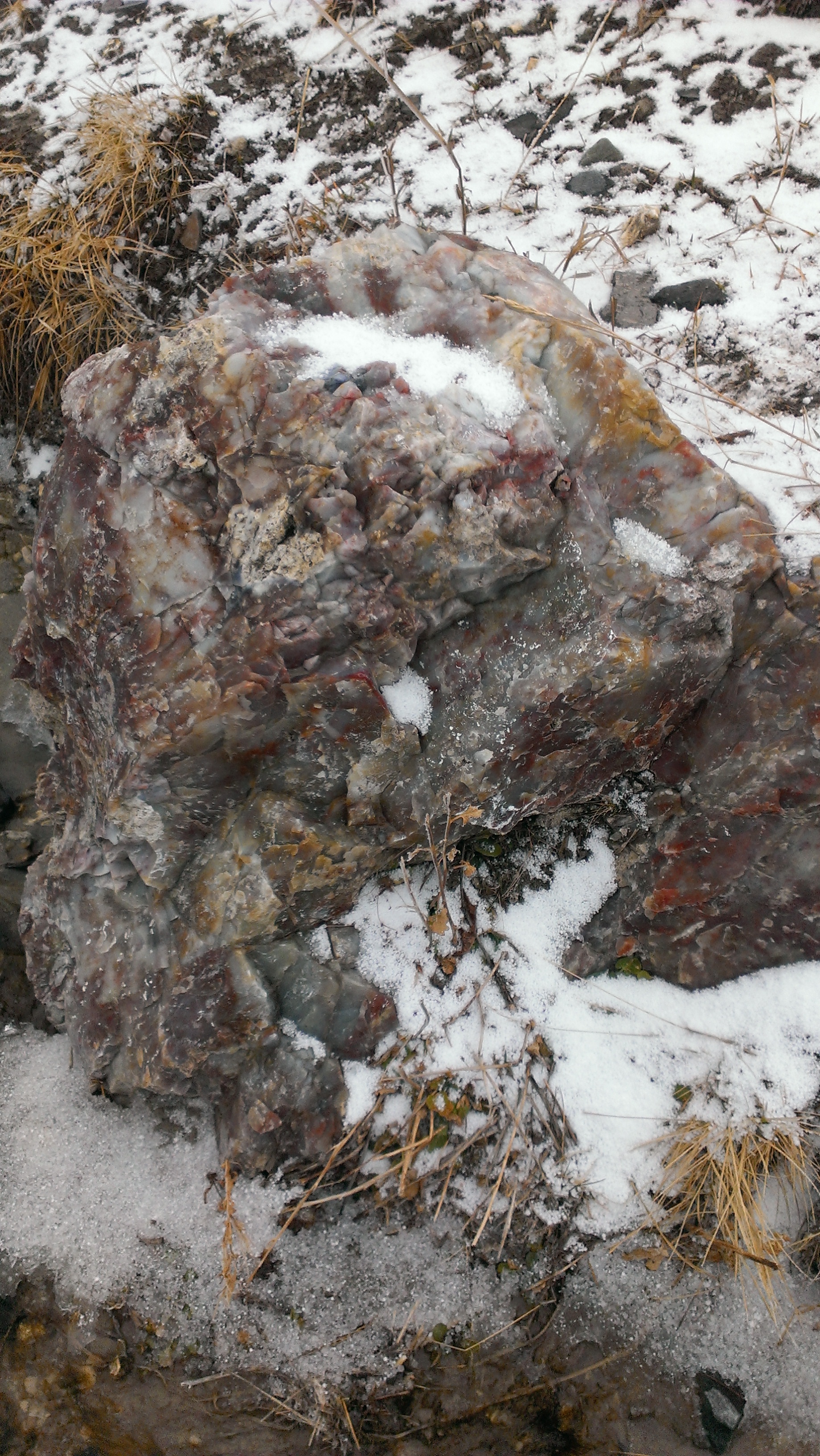
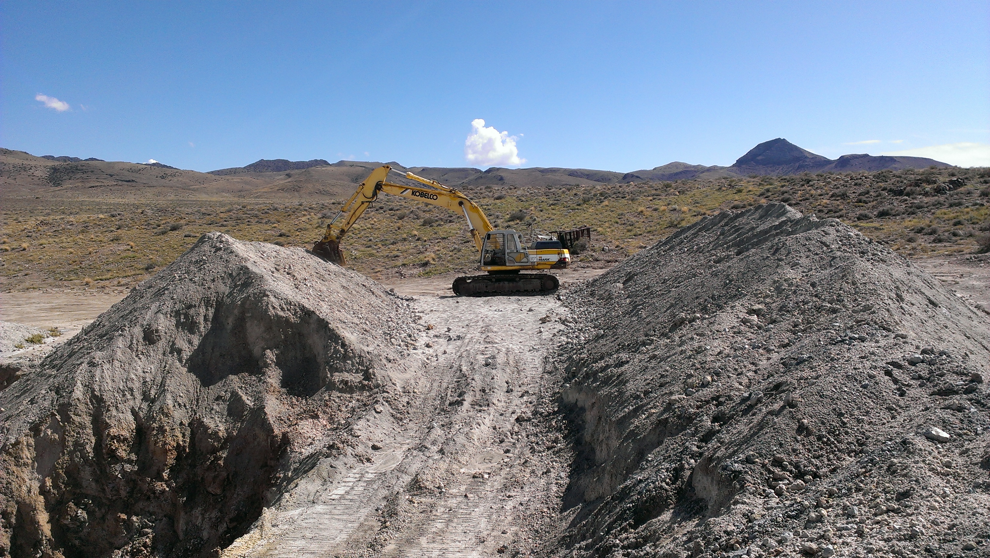
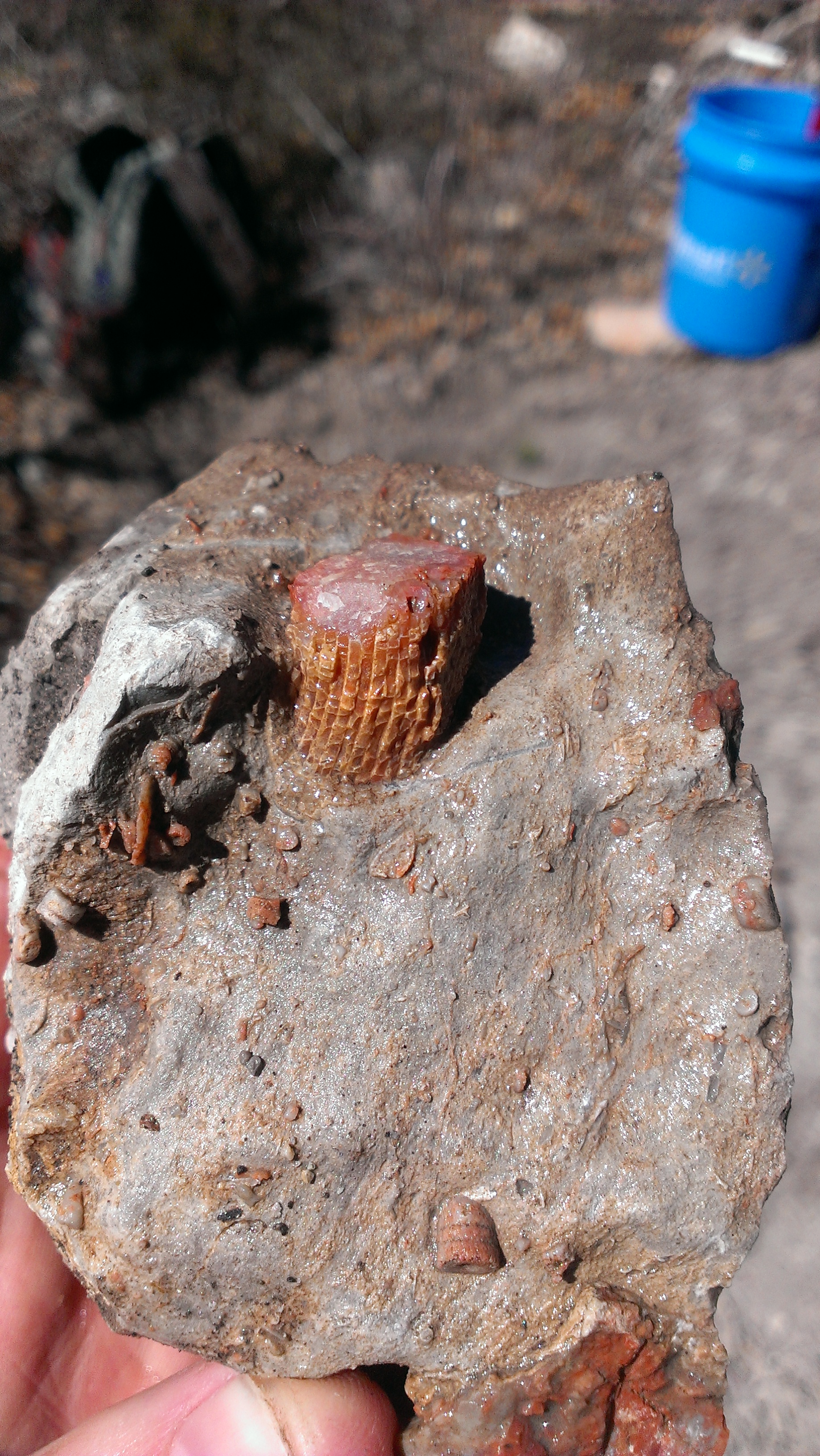
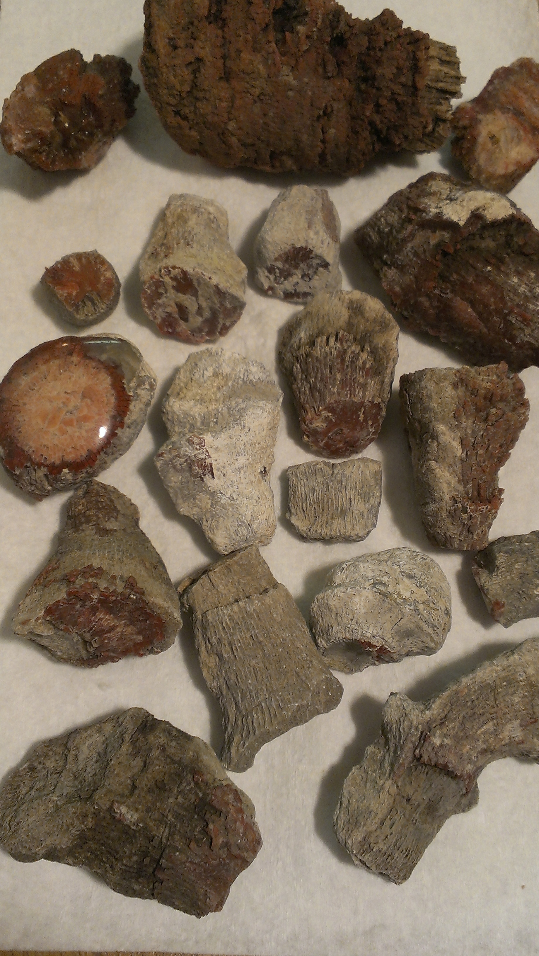
You can imagine at this point that we were frantically digging with berserk-like fury for anything and everything that resembled what we were looking for, knowing that it might be weeks or even months before we would be able to return. We did find several specimens, but our enthusiasm to return to this location is off the charts.

IMAG0600
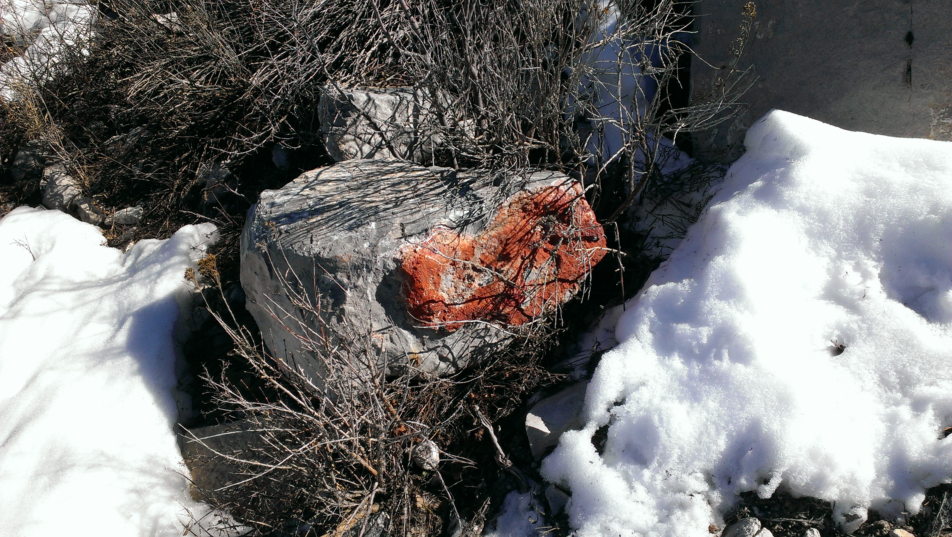
I should mention that even before finding the actual human digs that we did come across a large hole dug by an animal of some kind. Upon rooting through the pile of dirt around the hole, much to our surprise, we found a rather large specimen. Obviously, it seems silly to randomly dig holes all over the mountainside, but you might have similar luck checking holes where someone (or something) has already done the work for you.


IMAG0598
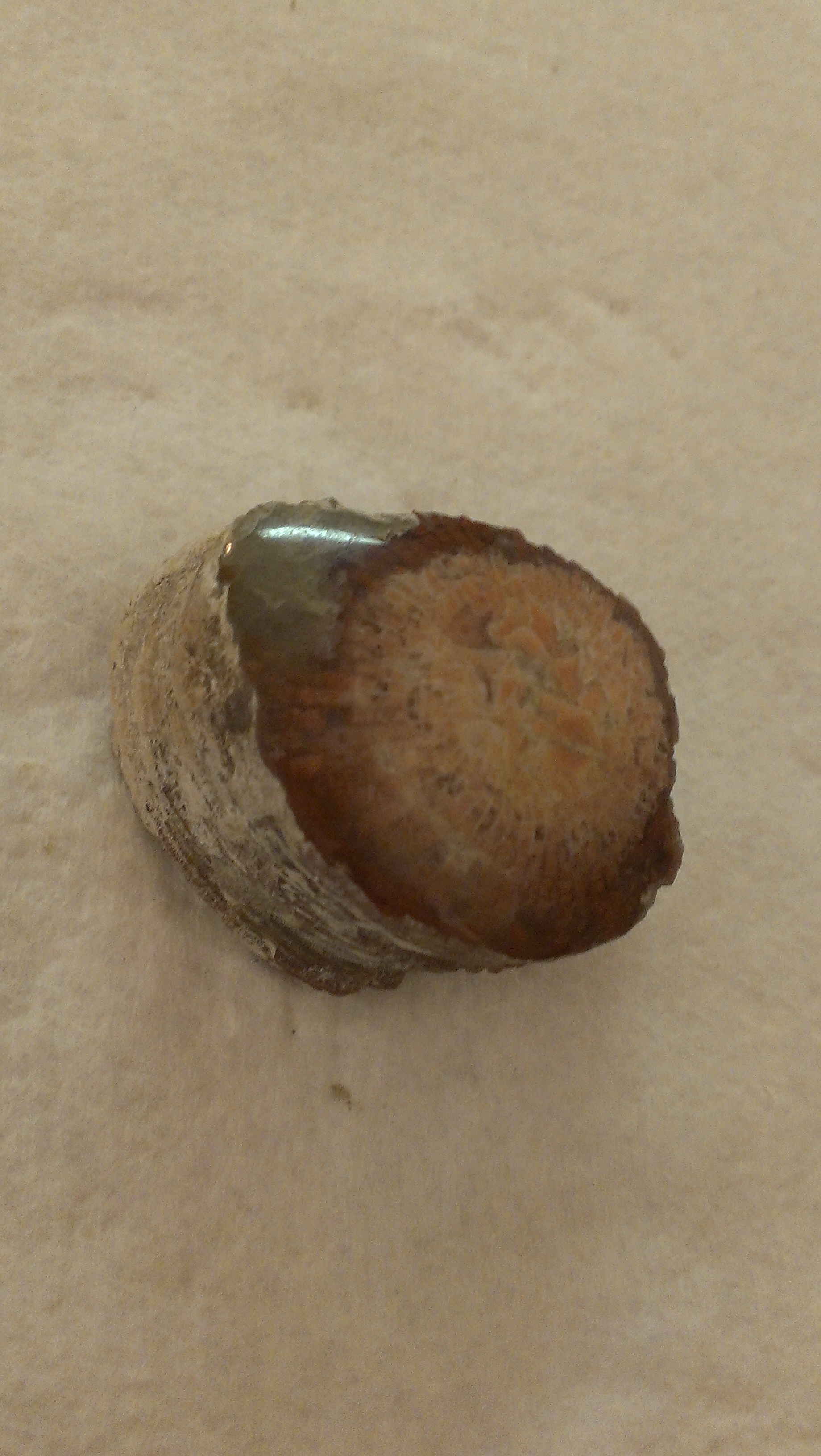
Directions to Red Horn Coral:

From the intersection of 800 North and I-15 in Orem, Utah

1. Drive East on 800 North for 3.7 miles to the Provo Canyon turnof

2. Take ramp on left onto US-189 N/E Provo Canyon Road

3. Drive 21.5 miles and turn left (North) onto US-189 N/Us-40 W/South Main Street in Heber

4. Drive 4.7 miles and turn right (Northeast) onto N State Road 32

IMAG05845. Drive another 10.4 miles to the four way stop in the town of Francis and go straight onto UT-35 East/W Main Village Way

6. Continue another 6.0 miles to destination on left (there is a parking area at the base of the canyon)

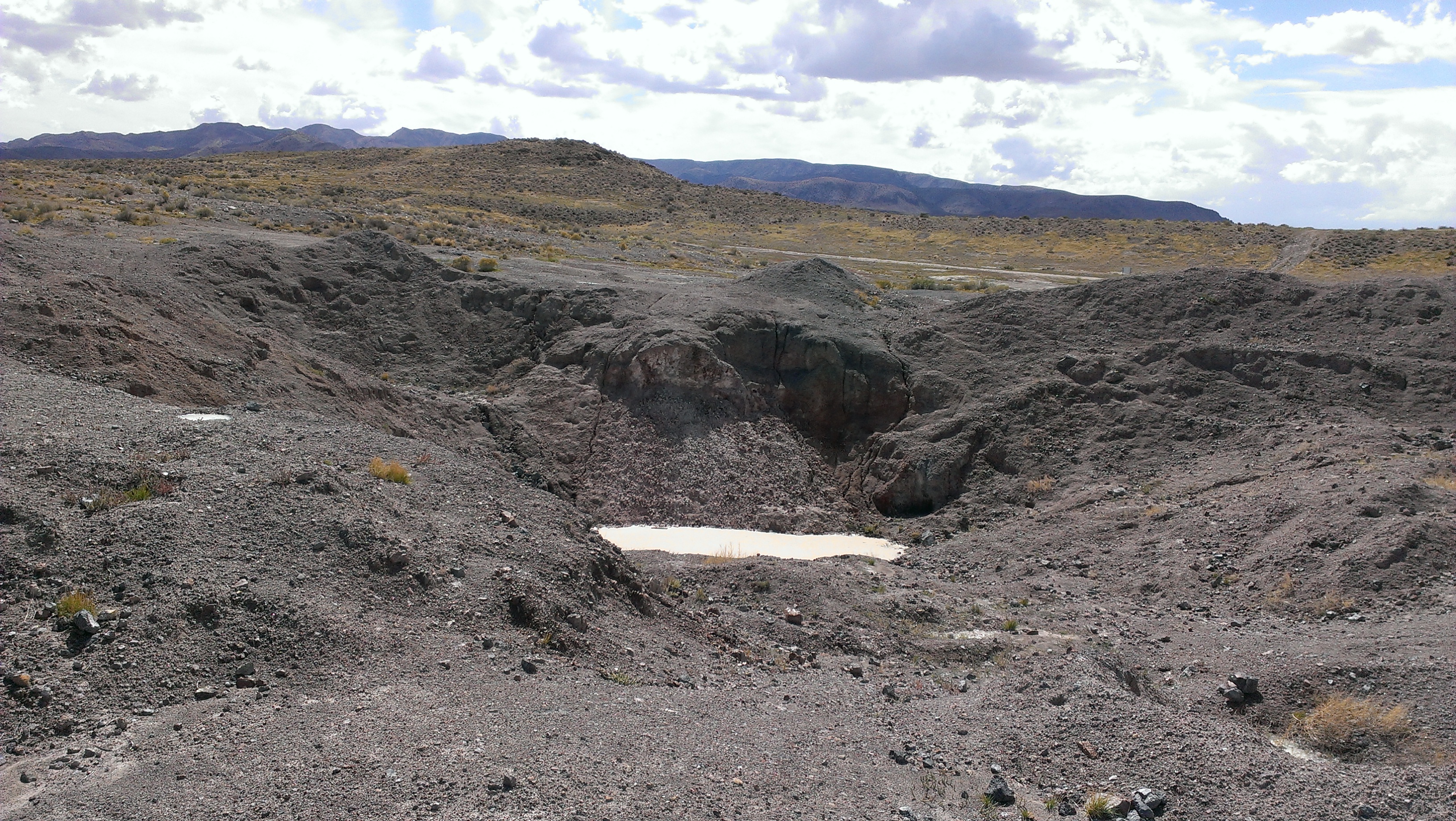
7. You’ll now begin your hike into Riley’s canyon. Take the main trail from the road and hike just barely over 1 mile and you will see the digs up on the mountain to your left about 180 feet from the trail

8. If you start seeing the huge white tailings residue on the left side of the trail you went just a little too far (but in reality you might see success searching all over this area)

Agate Hill near Bryce Canyon

The second location we decided to visit this weekend was on the other side of Highway 143 near the town of Panguitch (“the Gateway to Bryce Canyon National Park”). I’m sure there are multiple “agate hills” throughout the world, but the two I know of in Utah are one located in the Drum Mountains South of Topaz Mountain and another one located Southeast of Panguitch near the West wall of Bryce Canyon National Park.

This “Agate Hill” is truly a hill made up almost entirely of agate–just about every single rock you pick up will be some sort of agate. As such, this truly is an agate-lover’s paradise with multiple colors, multiple varieties, and an abundance of material. If you remember, we were coming from the Brian Head location and I noticed we passed several lava flows on Highway 143 while en route to this location. From my limited knowledge on how agates are formed, I assumed that the numerous amount of agate material was due to these large ancient lava beds.

If you get bored searching the hill itself, I would highly recommend meandering around the washes surrounding the hill, especially to the East when you start getting into the red sand. I’ve heard of some really cool fossils people have found in the area. Bryce Canyon is my favorite National Park in Utah and, although the views from this area are mesmerizing in and of themselves, I would highly recommend a quick trip into the park itself. It is one of the few National Parks you can explore and take in most of it in just one day.

We didn’t run into too many other people around the area (Probably because of the season), but I did notice that many of the trees on and around the hill had been cut down with all of the limbs cut off and left there. This made for an easy scoping of the area, but I didn’t know the reason for it.

Again, as with many of the other locations I have been to and mention on this site, the directions to this place were completely off-base in the other books and references I was using so I have corrected that below. As always, please let me know if you have any new information on ANY of these locations or if I have any incorrect information. I don’t want to lead any of you astray!

Directions to Agate Hill near Bryce Canyon:

From the intersection of 800 North and I-15 in Orem, Utah

1. Drive South on I-15 for 178.4 miles until exit 95 toward US-89/Panguitch/Kanab

2. Turn left (East) onto UT-20 E and drive 20.5 miles to US-89

3. In the town of Panguitch, turn right (South) onto US-89 for 10.1 miles until you get to a dirt road on the left hand side called Casto Canyon Road

4. Turn onto Casto Canyon Road, cross the bridge and hang left, and drive 2.4 miles in total from the highway to the location on the left

Brian Head Agate

IMAG0496 Big J and I had the chance to do one last hoorah before winter sets in and snow covers all of our favorite spots. The goal was to fill up some buckets with agate to stare at and play around with while we remain cooped up all winter. As far as agate goes in Southern Utah, I am familiar with the “Summit” location near Cedar City, but had heard of some other great locations nearby to hit up.

The first place we visited was located near Brian Head ski resort (I do love snowboarding here with the Misses in the rockhounding offseason). We passed a group of young skiers just learning the basics on what little snow had fallen the day before. There is a small creek near the top of the resort running off of Brian Head summit that contains a fair amount of nice agate. The ground this day was lightly dusted with snow and the creek was mostly frozen over, but we bundled up and braved the wind and the cold for a day of nice hunting.

IMAG0491I noticed right off the bat several large boulders of agate just chilling right there in the creek. They were definitely picture worthy!–Reds, yellows, blues, blacks, and whites mostly, but we only explored a small section of the river. I noticed some jasper there too as you usually would see. It is always good to have water or a spray bottle nearby when hunting for agates to get an idea of what each specimen will look like when polished so this location with the creek running right through the middle was ideal.

We parked on the road there and spent the majority of the time on the lower end of the river. It seemed like the agate was bedded up in the North bank of the creek and flowed right down into the water. Even with the cold weather, the ground was quite soft and so we didn’t really need any of the tools we had brought–only buckets to fill up 🙂

IMAG0494The beauty of the area surrounding this location really is extraordinary. Vast meadows and snow capped peaks with rolling hills of red rocks around the horizon. It is definitely NOT what you would picture Southern Utah to look like, but I’d say well worth the trip even just for the views.
Like many of the other locations I have on this site, the directions and distances can and will vary quite a bit from what you will see in books or on other websites. I always use Google Maps (especially the satellite view or Google Earth) to get these locations down to as exact as I possibly can.

Directions to Brian Head Agate:

From the intersection of 800 North and I-15 in Orem, Utah

IMAG0497 1. Drive South on I-15 for 194 miles until exit 78 toward UT-143/Parowan/Paragonah

2. Turn left (South) onto North Main Street for 1.2 miles

3. Turn left (East) onto East Center Street (turns slightly right and becomes Highway 143) for 14.9 miles until Brian Head Peak Road

4. Turn left (East) onto Brian Head Peak Road and drive .4 miles to the creek that runs right under the road

Dugway Geode Beds

IMAG0453Many people like to combine their trip out to Topaz Mountain with a stop over to the Dugway Geode Beds because of their close proximity to each other. The Dugway Geode Beds location includes a private claim owned by the Crapo family based out of Delta, Utah. They manage a rock shop in their backyard called “the Bug House” in addition to overseeing the Dugway Geode Beds claim as well as the the U-Dig trilobite claim further West of Delta.

Although you can dig for geodes outside of the claim, you will have far better luck getting permission from the claim-owners to collect on the actual claim. The fee for collecting on the claim is just $30 and you can contact the owners at 435-864-2402 or [email protected] ahead of time to arrange your visit. A liability waiver must also be signed before entering the site.

EDIT: The family who owns the Bug House contacted me and gave me an update–“We have recently lost Dugway geode claims to the BLM. We were late on a maintenance waiver and the BLM was able to take them away. Please update your website letting people know there is no longer a fee to dig geodes. We are working to try and get our claims back but for the time being it is now free for all public to go get as many geodes as you want. We haven’t been digging out there since we lost the claims so it wont be as easy as it used to be to find geodes.”

DugwayprivateYou might even get lucky and schedule your time while the claim owners are on location. I’ve heard they are very helpful in explaining the history behind the geodes and in finding the best and largest specimens to make sure people go home happy. They have an excavator on site and are constantly digging up new clay to sift through to get to the geodes.

Most of the Dugway geodes I have collected have been hollow and full of chalcedony and beautiful druzy quartz crystals. The colors most seen are clear, white, purple, and pink (I really like the pink ones for some reason). Some collectors have found geodes also containing jasper or calcite, barite, or amethyst crystals which is a real treat. It will be tempting to crack them open right there on site with your rock hammer to see what each one contains, but don’t fall into that trap. I can promise you that they will look much better on your shelf with a clean cut and polish 🙂

IMAG0452 You’ll want to look for the semi spherical white rocks that sometimes have smaller lumps on them. Some of them might even have the septarian-like turtle shell looking exterior. You should be able to gather which ones are more hollow or contain cavities by the weight alone. Sometimes, you might even find conjoined ones which are always fun to cut open. You never know what you might find!

Directions to Dugway Geode Beds:

From the intersection of 800 North and I-15 in Orem, Utah

IMAG0454 1. Drive North on I-15 for 6.5 miles to exit 278

2. Take exit 278 and turn left (West) onto Pioneer crossing

3. Drive for 6.5 miles and turn right (North) on Redwood Road

4. Drive on Redwood Road for one mile to Main Street/Highway 73 and take a left (West) at that light

5. Drive on Highway 73 for 20.9 miles through the towns of Eagle Mountain, Cedar Fort, and Fairfield until the highway starts to turn back Northwestward

6. Take that left (West) toward the town of Faust for 13.6 miles

7. You will cross railroad tracks and eventually run into Highway 36 running North to South

8. Turn left (South) on Highway 36 for .6 miles and then turn right (West) onto the Pony Express Road

9. Drive for 49.5 miles on Pony Express Road until you see the brown sign on the right for the geode beds

10. From here the trail turns sketchy and I would recommend a high clearance vehicle to navigate the roads through the beds

You can dig pretty much anywhere, but the claim is located near the Northeast corner of the beds and the easiest route to get there is to take the road that wraps wide around the left side and pops out on the North side of the claim.

North of Milford

First off, let me mention that I have only been to this location once. I later learned that the property is actually under private claim. I am unsure who the owner is or how one would contact them, but I met other people there when I went and I remember seeing evidence of lots of activity in that area so it would seem that most people disregard this fact. (For those interested, the rumor is that ebay user Carver2 is the owner of the claim).

This location is right next door to a geothermal plant and, from what I understand, the underground geothermal activity is actually what led to the formation of this unique type of opal. It is commonly called Bacon or Candy Strip Opal, but is also referred to as Hyalite Opal.

For those who have been North of Milford, you will already know that the area is extremely windy (You’ll pass hundreds of windmills on the way down from Delta). This usually makes for a great adventure and you may want to bring a kite or a pinwheel or something for the kids.

The opal is one of those things you really have to see with your own eyes to appreciate the attractiveness of this mineral. It is layered and the colors can range quite a bit. I’ve seen some of the cabs and other jewelry people have made from this type of opal and really is quite exquisite. The recurring colors I was seeing were yellow, white, brown, pink, red, orange, and grey.

I hope to return to this location in the future, but I’m hesitant with the knowledge that it is still most likely under claim. Nevertheless, it is a good location to add to Utah’s vast database of rockhounding opportunities!

UPDATE:

The owner of the claim, Jerry, commented below and I want to include the information he provided in the post itself…

“Hello! My name is Jerry, and I was looking at your website and was very impressed with your description of the Milford Opal mine that I have leased from the State. I am offering Field Trips to the public by Scheduled Appointment.
So come and enjoy some quality time with your friends and family collecting these exquisite Opals!
One, 1 gal Bucket not to Exceed 10 lbs is only $ 40.00
One, 3 gal Bucket not to Exceed 30 lbs is only $ 80.00
One, 5 gal Bucket not to Exceed 50 lbs is only $100.00
Pricing Discounts for Large Groups and Clubs!
Just call: Jerry at (801) 503-8736 for a Date and Time.”

Directions to North of Milford:

From the intersection of 800 North and I-15 in Orem, Utah

1. Drive South on I-15 for 43.7 miles

2. Take Nephi exit 228 and keep right on Main Street (SW) for 2.7 miles

3. Turn Right (West) on W 100 North for 33.2 miles until you hit Highway 6

4. Turn left (South) on Highway 6 for 16 miles until you hit Highway 50

5. Take a right (West) into the town of Delta on Highway 50 for 5.5 miles

6. Turn left (South) on Highway 257 toward Milford for  65.0 miles and then take a left (East)

7. Drive for 7.2 miles and the destination will be on the right (South)